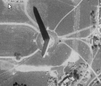
Looking around the White House area, you can clearly see people. I'm thinking 1 foot. This is a lot clearer than Terraserver. I've attached a shot from the Terraserver database of the Washington monument. It's 1 meter as I said. We use Terraserver from within ArcView which automatically places the image on our GIS system. We use it to spot pipelines.

 Previous Topic
 Index
Index
